 Miklat
Find the nearest shelter in seconds
Miklat helps you locate bomb shelters and safe rooms across Israel. Community-verified, multi-language, always ready.


Everything you need in an emergency
Miklat helps you locate bomb shelters and safe rooms across Israel. Community-verified, multi-language, always ready.
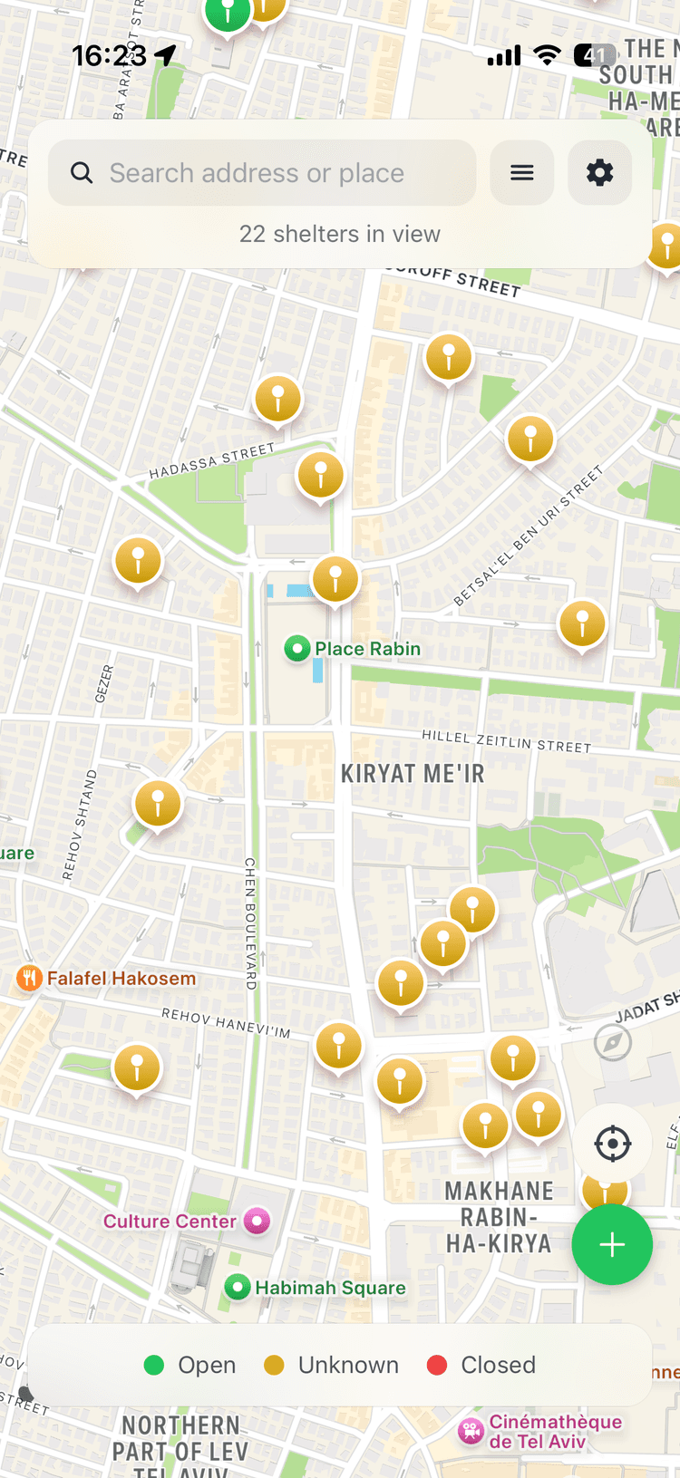
Map-Based Finder
See all shelters near you on an interactive map with real-time status indicators.
Community Verified
Shelters are verified by real people. Confirm if a shelter is open, closed, or needs attention.
5 Languages
Available in Hebrew, English, Arabic, French, and Russian with full RTL support.
Instant Directions
Get walking or driving directions via Google Maps, Waze, or Apple Maps.
Add Shelters
Know a shelter that's not on the map? Add it and help your community.
Accessibility Info
Filter shelters by accessibility level, floor number, and stair availability.
How it works
Open the app
Launch Miklat on your phone or open the web map.
Find shelters nearby
The map automatically shows shelters closest to your location.
Get directions
Tap a shelter and get instant walking directions.
Roadmap
Where we've been and where we're going.
Store Release
App Store and Play Store launch with screenshots, privacy policy, and production builds.
Post-Launch Stability
Auto-select closest shelter, client-side caching, CDN fallback, 14,967 GovMap shelters imported.
Polish & UX
Shelter types, accessibility filter, walking routes, admin dashboard, and React 19 compatibility.
Community & Verification
Open/closed voting, report system, shelter amenities editing, verify button, and splash screen.
Map Migration & Android
Migrated to Apple Maps (iOS) and Google Maps (Android). Follow mode, voting improvements, Android launch.
Free API Migration
Replaced paid Google APIs with Mapbox and OpenStreetMap. Walking directions, search, and crash fixes.
Native Rewrite
Separate Swift (iOS) and Kotlin (Android) apps. Map filters, Apple search, iPad, Mac, shelter photos, siren alerts, and push notifications.

